Proppant Research Group
The data displayed below were collected during a joint project between the following departments at Montana Tech of The University of Montana: Geophysical Engineering and the Montana Bureau of Mines and Geology. The samples represent sandstones collected and analyzed for their potential use as proppant material.
| Sample Name | B67-2 | Site Name | B67-JG |
|---|---|---|---|
| Latitude | 46.82427 | Longitude | -108.97627 |
| Geomethod | NAV-GPS | Datum | WGS84 |
| Elevation | 4485 | Township | 12N |
| County | FERGUS | Range | 22E |
| 100K Quad | MUSSELSHELL | Section | 5 |
| 24K Quad | BALD BUTTE | Quarter Section | DC |
| Sample Taken | YES | ||
| Sample Date | 9/18/2014 | Formation Name | Tyler Formation (IPMt) |
| Sampler Name | JAY GUNDERSON | Sampler Notes | SOUTH FORK RD WHERE ROAD VEERS W AND DROPS DOWN TOWARD CREEK BOTTOM; MIX OF LITHOLOGIES, CONGL, LS, SHALE, SS; MUNDT TYPE SECTION?, SAMPLED VF-F GRND YELLOW FRIABLE QTZ SAND; MUNDT TYPE SECTION |
| Thickness | 20 | Extent | 500 |
| References | |||
|
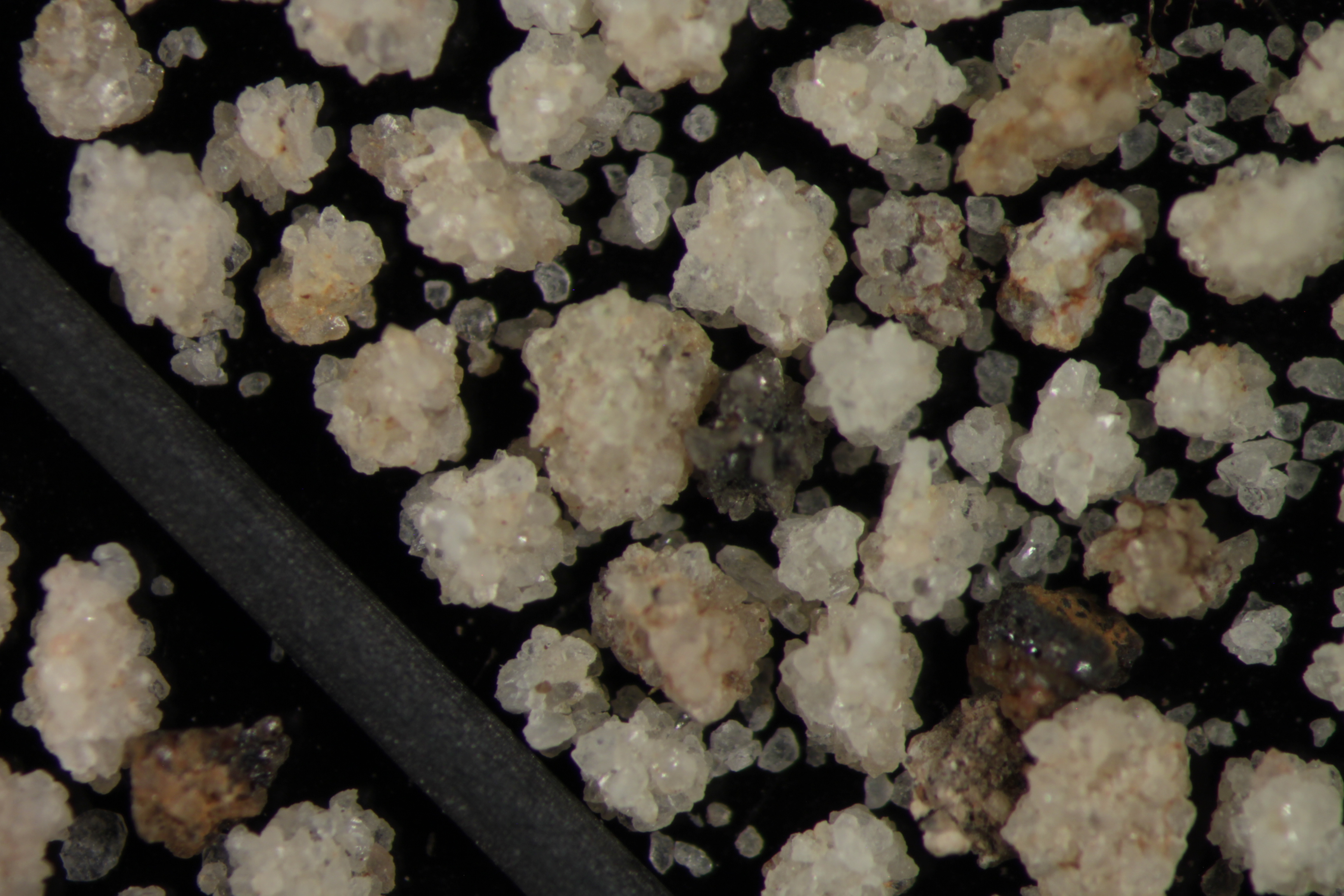
Site Photographs 


|
|||
| Meets API Minimum Standards | Minerology | ||||||||||||||||||||||||||||||||||||||||||||||||||||||||||||||||||||||||
|---|---|---|---|---|---|---|---|---|---|---|---|---|---|---|---|---|---|---|---|---|---|---|---|---|---|---|---|---|---|---|---|---|---|---|---|---|---|---|---|---|---|---|---|---|---|---|---|---|---|---|---|---|---|---|---|---|---|---|---|---|---|---|---|---|---|---|---|---|---|---|---|---|---|
| NO | QUARTZ | ||||||||||||||||||||||||||||||||||||||||||||||||||||||||||||||||||||||||
| Pre Wash Weight (g) | Post Wash Weight (g) | ||||||||||||||||||||||||||||||||||||||||||||||||||||||||||||||||||||||||
| 546 | 521.5 | ||||||||||||||||||||||||||||||||||||||||||||||||||||||||||||||||||||||||
| Material Notes | |||||||||||||||||||||||||||||||||||||||||||||||||||||||||||||||||||||||||
|
Sieving Results Reported Sample Weight (g): 106.6
|
|||||||||||||||||||||||||||||||||||||||||||||||||||||||||||||||||||||||||
| Sphericity | 0.64 |
|---|---|
| Roundness | 0.64 |
| First Primary | 70 |
| Second Primary | 140 |
|
Available Documents  View document [B67_2_PRECRUSH2015_7_15_14_39_42.pdf] View document [B67_02_CRUSH_5K_INCORRECT_FILE_NAME2015_7_15_14_45_13.pdf] View document [B67_02_CRUSH6K2015_7_15_14_45_53.pdf] View document [B67_2_SPHERE_ROUND2015_12_14_13_36_56.pdf] View document [B67_2_PRECRUSH2015_7_15_14_39_42.pdf] View document [B67_02_CRUSH_5K_INCORRECT_FILE_NAME2015_7_15_14_45_13.pdf] View document [B67_02_CRUSH6K2015_7_15_14_45_53.pdf] View document [B67_2_SPHERE_ROUND2015_12_14_13_36_56.pdf] |
|