Proppant Research Group
The data displayed below were collected during a joint project between the following departments at Montana Tech of The University of Montana: Geophysical Engineering and the Montana Bureau of Mines and Geology. The samples represent sandstones collected and analyzed for their potential use as proppant material.
| Sample Name | TOWN-1-SV-14 | Site Name | TOWN-SV-14 |
|---|---|---|---|
| Latitude | 46.12114 | Longitude | -111.408028 |
| Geomethod | NAV-GPS | Datum | WGS84 |
| Elevation | 3977 | Township | 04N |
| County | GALLATIN | Range | 03E |
| 100K Quad | TOWNSEND | Section | 7 |
| 24K Quad | LOMBARD | Quarter Section | BB |
| Sample Taken | YES | ||
| Sample Date | 9/24/2014 | Formation Name | Quadrant Formation (*q) |
| Sampler Name | SUSAN VUKE | Sampler Notes | TOSTON DAM RD AT TOSTON DAM |
| Thickness | ~200 FT | Extent | OC EXTENDS ACROSS MEANDER LOOP |
| References | |||
| Meets API Minimum Standards | Minerology | ||||||||||||||||||||||||||||||||||||||||||||||||||||||||||||||||||||||||
|---|---|---|---|---|---|---|---|---|---|---|---|---|---|---|---|---|---|---|---|---|---|---|---|---|---|---|---|---|---|---|---|---|---|---|---|---|---|---|---|---|---|---|---|---|---|---|---|---|---|---|---|---|---|---|---|---|---|---|---|---|---|---|---|---|---|---|---|---|---|---|---|---|---|
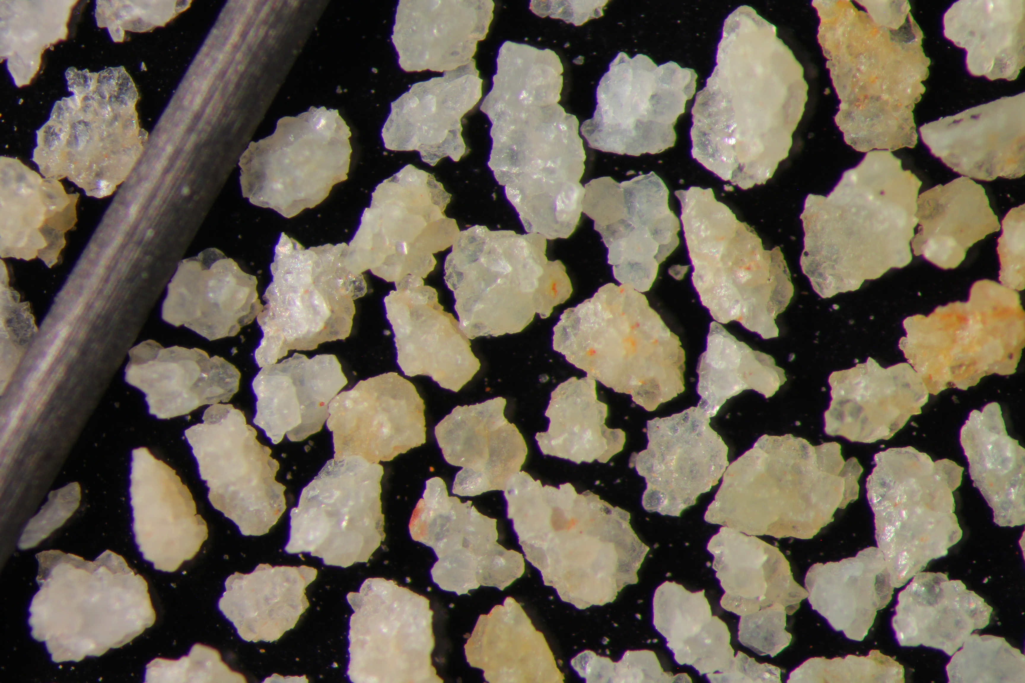
| NO | QUARTZ | ||||||||||||||||||||||||||||||||||||||||||||||||||||||||||||||||||||||||
| Pre Wash Weight (g) | Post Wash Weight (g) | ||||||||||||||||||||||||||||||||||||||||||||||||||||||||||||||||||||||||
| 656.2 | 522.8 | ||||||||||||||||||||||||||||||||||||||||||||||||||||||||||||||||||||||||
| Material Notes | |||||||||||||||||||||||||||||||||||||||||||||||||||||||||||||||||||||||||
|
Sieving Results Reported Sample Weight (g): 99.7
|
|||||||||||||||||||||||||||||||||||||||||||||||||||||||||||||||||||||||||
| Sphericity | |
|---|---|
| Roundness | |
| First Primary | 40 |
| Second Primary | 70 |
|
Available Documents  View document [TOWN_1_PRECRUSH0562015_8_13_10_10_8.pdf] View document [TOWN_1_PRECRUSH0562015_8_13_10_10_8.pdf] |
|