Proppant Research Group
The data displayed below were collected during a joint project between the following departments at Montana Tech of The University of Montana: Geophysical Engineering and the Montana Bureau of Mines and Geology. The samples represent sandstones collected and analyzed for their potential use as proppant material.
| Sample Name | A28-1 | Site Name | A28-JG |
|---|---|---|---|
| Latitude | 46.96988 | Longitude | -108.940717 |
| Geomethod | NAV-GPS | Datum | WGS84 |
| Elevation | 4006 | Township | 14N |
| County | FERGUS | Range | 22E |
| 100K Quad | MUSSELSHELL | Section | 16 |
| 24K Quad | BECKET | Quarter Section | CD |
| Sample Taken | YES | ||
| Sample Date | 7/24/2013 | Formation Name | Tyler Formation (IPMt) |
| Sampler Name | JAY GUNDERSON | Sampler Notes | 1.5 MI SO ON DIXON RD; BRANCH RIGHT & CROSS ATHERTON CK; A28-1 WHITE VF SS W/ RED HMTITE SPOTS, BANDED WHITE/PURPLE; OVERLYING BLACK FISSILE SHALE |
| Thickness | 8 | Extent | 200 |
| References | |||
|
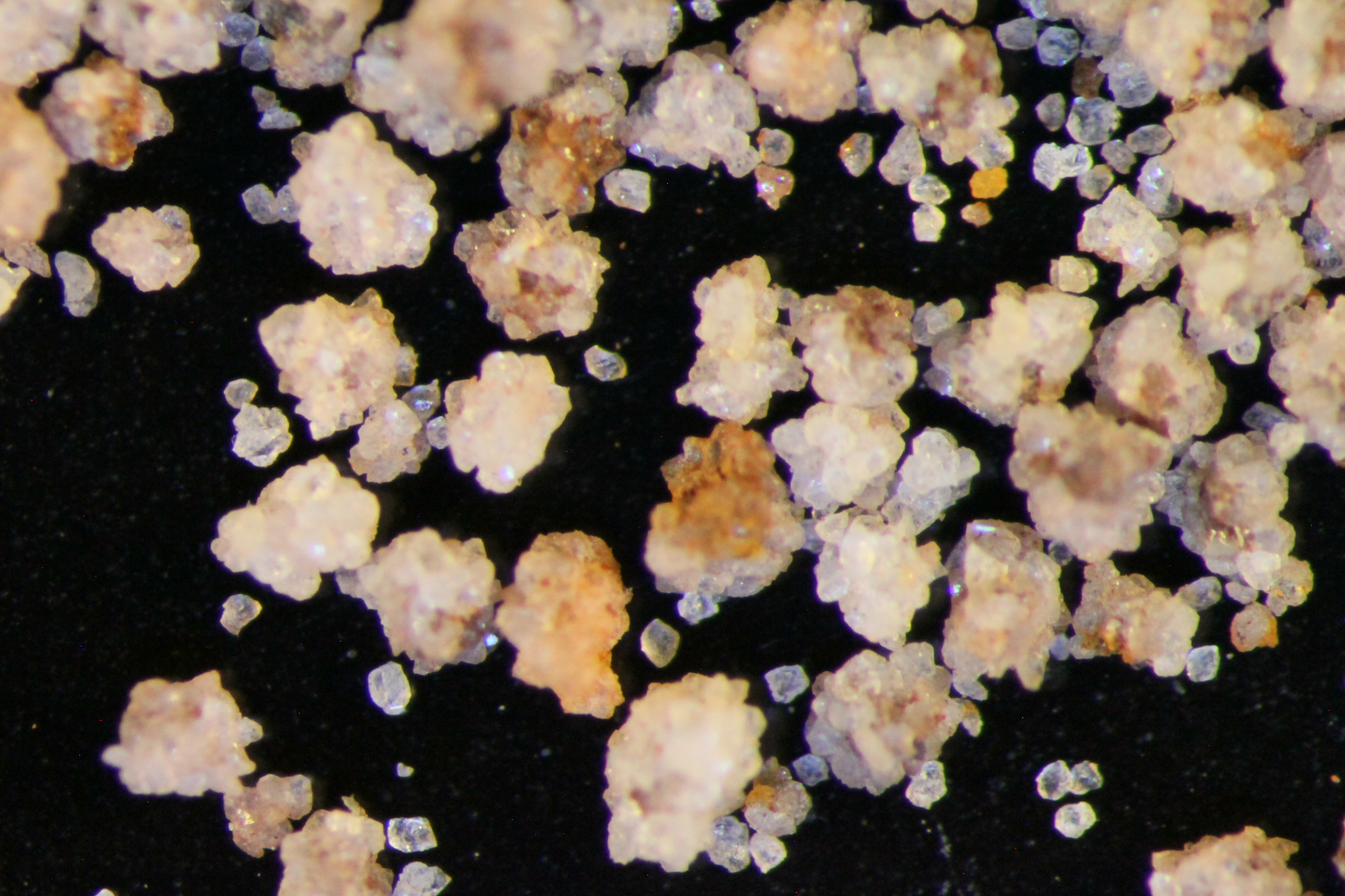
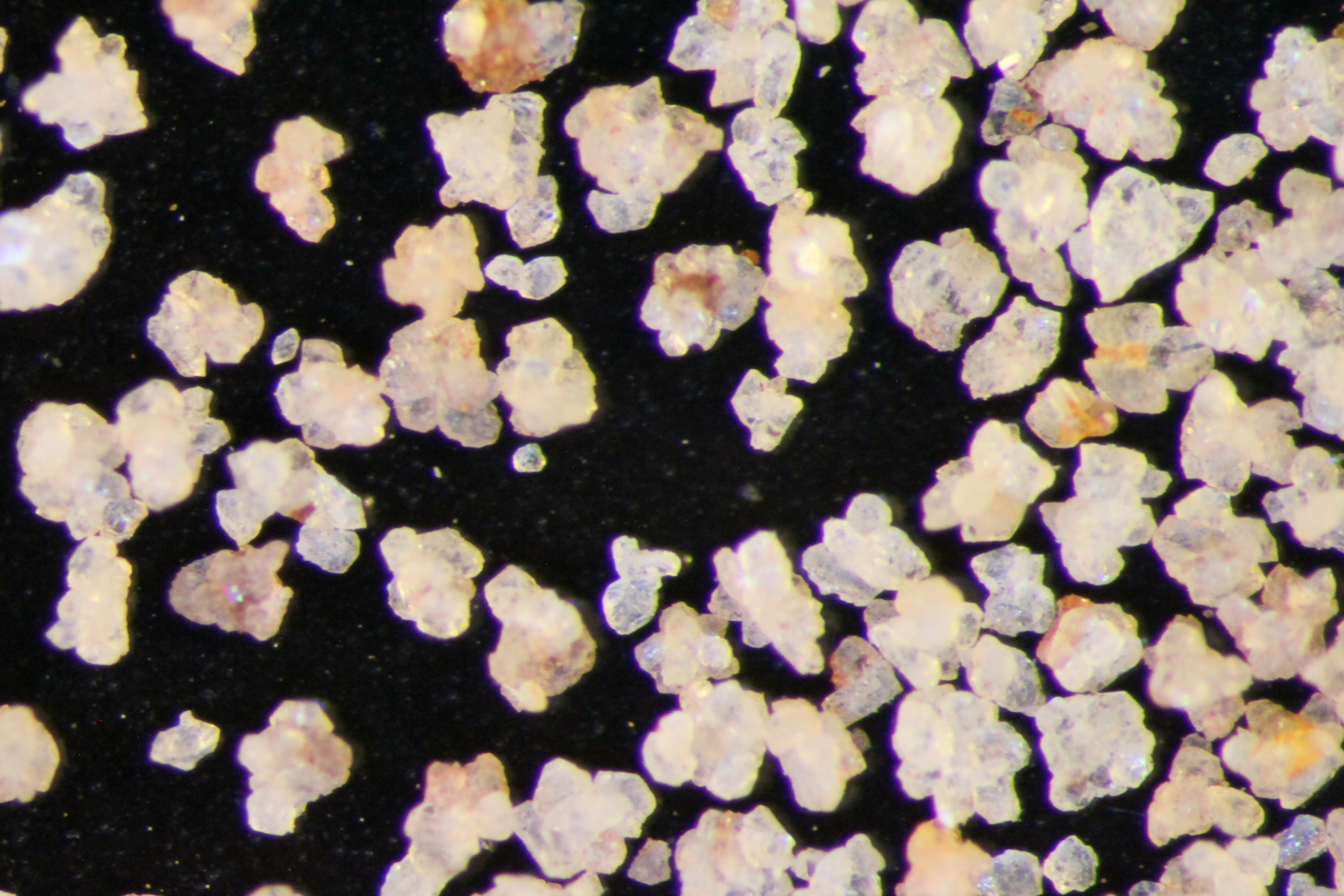
Site Photographs 

|
|||
| Meets API Minimum Standards | Minerology | ||||||||||||||||||||||||||||||||||||||||||||||||||||||||||||||||||||||||
|---|---|---|---|---|---|---|---|---|---|---|---|---|---|---|---|---|---|---|---|---|---|---|---|---|---|---|---|---|---|---|---|---|---|---|---|---|---|---|---|---|---|---|---|---|---|---|---|---|---|---|---|---|---|---|---|---|---|---|---|---|---|---|---|---|---|---|---|---|---|---|---|---|---|
| NO | QUARTZ | ||||||||||||||||||||||||||||||||||||||||||||||||||||||||||||||||||||||||
| Pre Wash Weight (g) | Post Wash Weight (g) | ||||||||||||||||||||||||||||||||||||||||||||||||||||||||||||||||||||||||
| Material Notes | |||||||||||||||||||||||||||||||||||||||||||||||||||||||||||||||||||||||||
|
Sieving Results Reported Sample Weight (g): 208.42
|
|||||||||||||||||||||||||||||||||||||||||||||||||||||||||||||||||||||||||
| Sphericity | 0.65 |
|---|---|
| Roundness | 0.68 |
| First Primary | 70 |
| Second Primary | 140 |
|
Available Documents  View document [A28_01_SPHERE_ROUND2622015_10_30_14_32_46.pdf] View document [A28_01_PRECRUSH2016_2_5_10_41_14.pdf] View document [A28_01_SPHERE_ROUND2622015_10_30_14_32_46.pdf] View document [A28_01_PRECRUSH2016_2_5_10_41_14.pdf] |
|