

Proppant Research Group
The data displayed below were collected during a joint project between the following departments at Montana Tech of The University of Montana: Geophysical Engineering and the Montana Bureau of Mines and Geology. The samples represent sandstones collected and analyzed for their potential use as proppant material.
| Sample Name | A26-2 | Site Name | A26-JG |
|---|---|---|---|
| Latitude | 46.99803 | Longitude | -108.89852 |
| Geomethod | NAV-GPS | Datum | WGS84 |
| Elevation | 3950 | Township | 14N |
| County | FERGUS | Range | 22E |
| 100K Quad | MUSSELSHELL | Section | 2 |
| 24K Quad | BECKET | Quarter Section | CD |
| Sample Taken | YES | ||
| Sample Date | 7/24/2013 | Formation Name | Fall River Formation (Kfr) |
| Sampler Name | JAY GUNDERSON | Sampler Notes | 3.5 MI SO OF US87 ON MUNGER LN; A26-2 SMALL OC AT BASE OF DECENT OFF "PLATEAU", MORE FRIABLE?; FEW SMALL OC SCATTERED ALONG HILLSIDE, COULD BE UPPER KK |
| Thickness | 5 | Extent | 100 |
| References | |||
|
Site Photographs 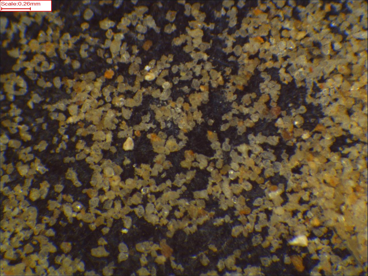

|
|||
| Meets API Minimum Standards | Minerology | ||||||||||||||||||||||||||||||||||||||||||||||||||||||||||||||||||||||||
|---|---|---|---|---|---|---|---|---|---|---|---|---|---|---|---|---|---|---|---|---|---|---|---|---|---|---|---|---|---|---|---|---|---|---|---|---|---|---|---|---|---|---|---|---|---|---|---|---|---|---|---|---|---|---|---|---|---|---|---|---|---|---|---|---|---|---|---|---|---|---|---|---|---|
| NO | QUARTZ | ||||||||||||||||||||||||||||||||||||||||||||||||||||||||||||||||||||||||
| Pre Wash Weight (g) | Post Wash Weight (g) | ||||||||||||||||||||||||||||||||||||||||||||||||||||||||||||||||||||||||
| Material Notes | |||||||||||||||||||||||||||||||||||||||||||||||||||||||||||||||||||||||||
|
Sieving Results Reported Sample Weight (g): 139.87
|
|||||||||||||||||||||||||||||||||||||||||||||||||||||||||||||||||||||||||
| Sphericity | |
|---|---|
| Roundness | |
| First Primary | 70 |
| Second Primary | 140 |
|
Available Documents  View document [A26_02_PRECRUSH2692016_1_7_10_27_40.pdf] View document [A26_02_PRECRUSH2692016_1_7_10_27_40.pdf] |
|


