Proppant Research Group
The data displayed below were collected during a joint project between the following departments at Montana Tech of The University of Montana: Geophysical Engineering and the Montana Bureau of Mines and Geology. The samples represent sandstones collected and analyzed for their potential use as proppant material.
| Sample Name | A22-1 | Site Name | A22-JG |
|---|---|---|---|
| Latitude | 46.907234 | Longitude | -109.077612 |
| Geomethod | MAP | Datum | NAD83 |
| Elevation | 5198 | Township | 13N |
| County | FERGUS | Range | 21E |
| 100K Quad | BIG SNOWY MOUNTAINS | Section | 9 |
| 24K Quad | FORESTGROVE | Quarter Section | BB |
| Sample Taken | YES | ||
| Sample Date | 7/23/2013 | Formation Name | Tyler Formation (IPMt) |
| Sampler Name | JAY GUNDERSON | Sampler Notes | SURENOUGH RD GOING E 1000' BEYOND N FORK RD TO S; A22-1 RED-STAINED F GRND QTZ SS, HEAVILY WEATHERED; 850' N OF ROAD, ~300YDS UP HILL FROM OTTER OC ON LEFT |
| Thickness | 25 | Extent | 1500 |
| References | |||
|
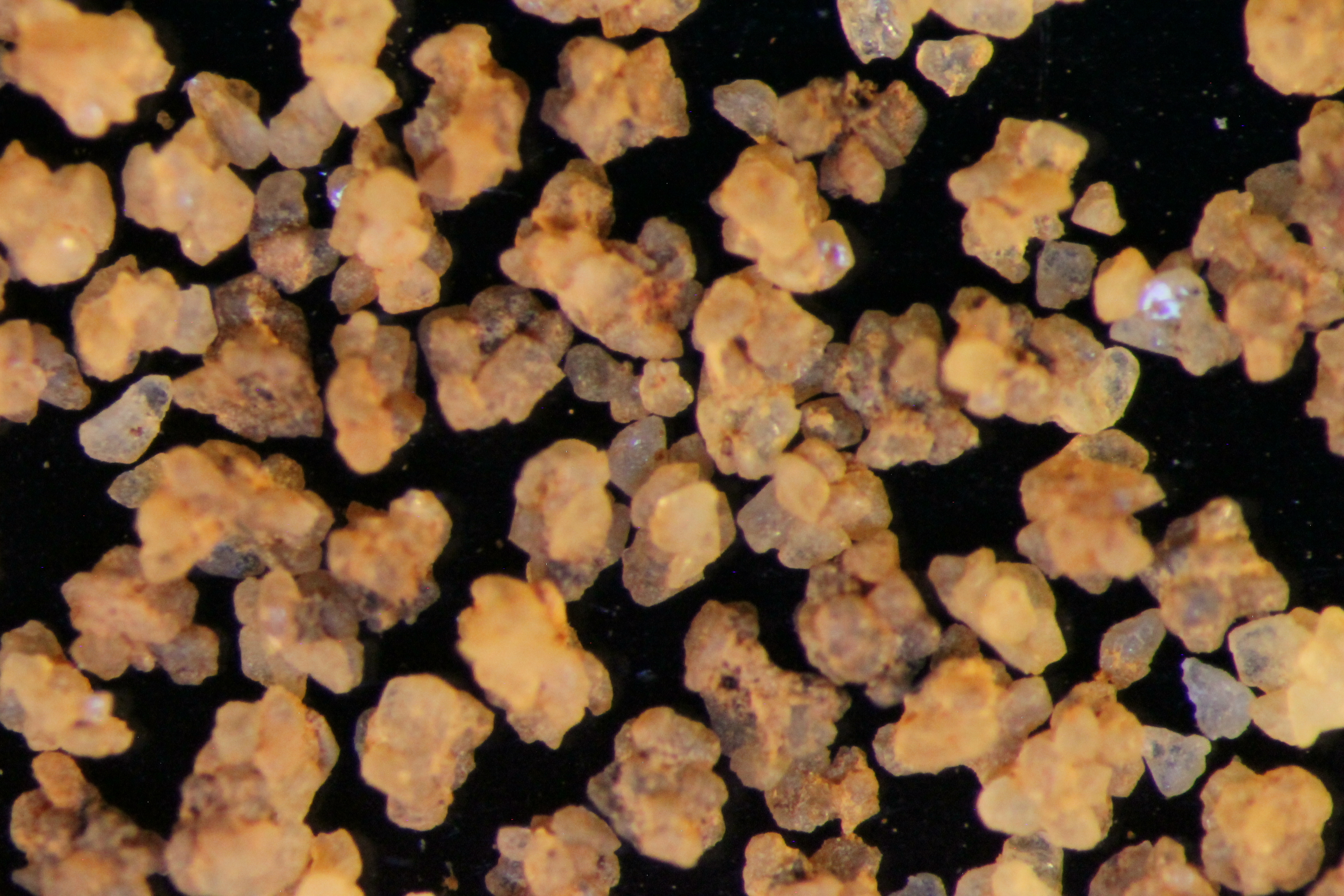
Site Photographs 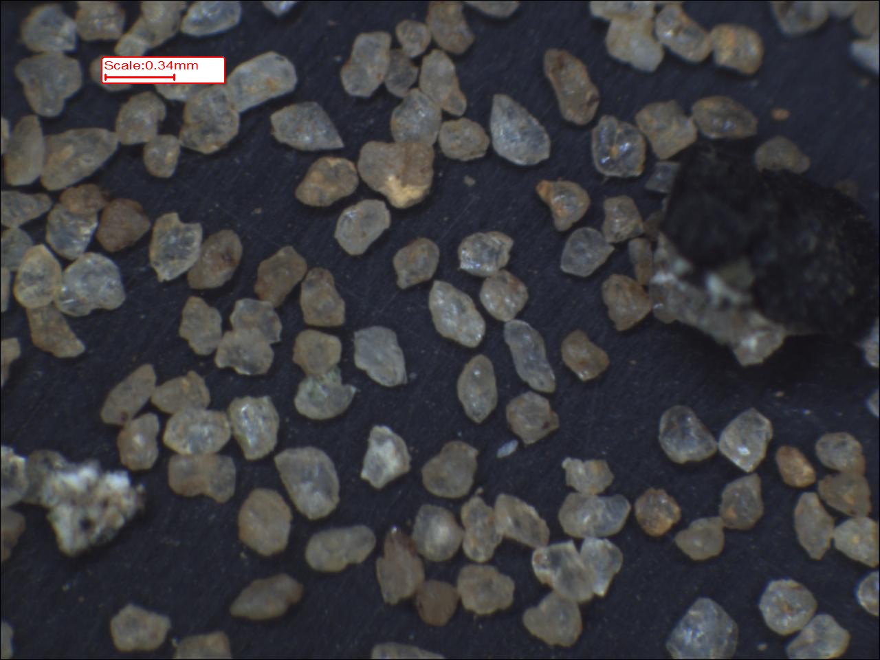


|
|||
| Meets API Minimum Standards | Minerology | ||||||||||||||||||||||||||||||||||||||||||||||||||||||||||||||||||||||||
|---|---|---|---|---|---|---|---|---|---|---|---|---|---|---|---|---|---|---|---|---|---|---|---|---|---|---|---|---|---|---|---|---|---|---|---|---|---|---|---|---|---|---|---|---|---|---|---|---|---|---|---|---|---|---|---|---|---|---|---|---|---|---|---|---|---|---|---|---|---|---|---|---|---|
| YES | QUARTZ | ||||||||||||||||||||||||||||||||||||||||||||||||||||||||||||||||||||||||
| Pre Wash Weight (g) | Post Wash Weight (g) | ||||||||||||||||||||||||||||||||||||||||||||||||||||||||||||||||||||||||
| Material Notes | |||||||||||||||||||||||||||||||||||||||||||||||||||||||||||||||||||||||||
|
Sieving Results Reported Sample Weight (g): 246.75
|
|||||||||||||||||||||||||||||||||||||||||||||||||||||||||||||||||||||||||
| Sphericity | 0.59 |
|---|---|
| Roundness | 0.55 |
| First Primary | 70 |
| Second Primary | 140 |
|
Available Documents  View document [A22_01_SPHERE_AND_ROUND2015_12_4_9_1_3.pdf] View document [A22_01_PRECRUSH2942015_12_4_9_1_20.pdf] View document [A22_01_SPHERE_AND_ROUND2015_12_4_9_1_3.pdf] View document [A22_01_PRECRUSH2942015_12_4_9_1_20.pdf] |
|