Proppant Research Group
The data displayed below were collected during a joint project between the following departments at Montana Tech of The University of Montana: Geophysical Engineering and the Montana Bureau of Mines and Geology. The samples represent sandstones collected and analyzed for their potential use as proppant material.
| Sample Name | C77-3 | Site Name | C77-3 |
|---|---|---|---|
| Latitude | 47.03485 | Longitude | -110.32383 |
| Geomethod | NAV-GPS | Datum | NAD83 |
| Elevation | 5049 | Township | 15N |
| County | JUDITH BASIN | Range | 11E |
| 100K Quad | BELT | Section | 27 |
| 24K Quad | CAYUSE BASIN | Quarter Section | BC |
| Sample Taken | YES | ||
| Sample Date | 7/28/2015 | Formation Name | Tyler Formation (IPMt) |
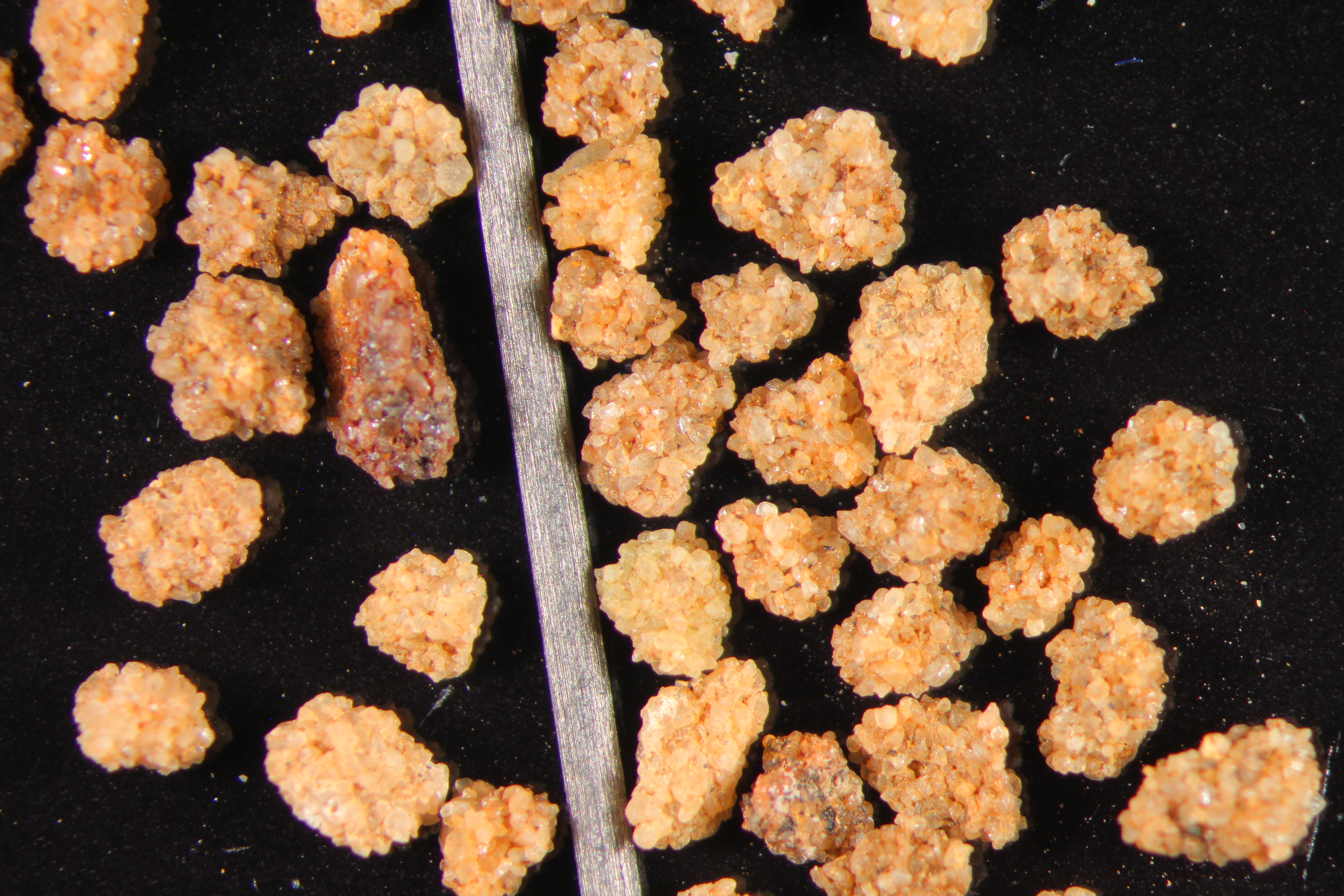
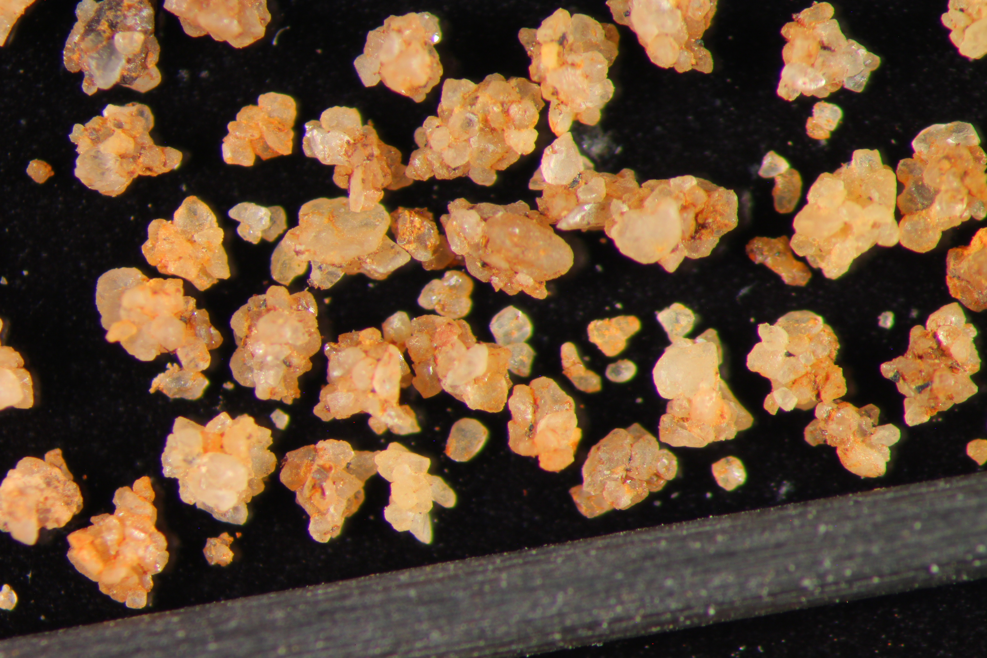
| Sampler Name | JAY GUNDERSON | Sampler Notes | TYLER SS - REDDISH-YELLOW QTZ SS MEDIUM(LOWER 0.250-0.350MM) GRND QTZ SS, SUBROUNDED, WELL SORTED |
| Thickness | 10 | Extent | 100 |
| References | |||
| Meets API Minimum Standards | Minerology | ||||||||||||||||||||||||||||||||||||||||||||||||||||||||||||||||||||||||
|---|---|---|---|---|---|---|---|---|---|---|---|---|---|---|---|---|---|---|---|---|---|---|---|---|---|---|---|---|---|---|---|---|---|---|---|---|---|---|---|---|---|---|---|---|---|---|---|---|---|---|---|---|---|---|---|---|---|---|---|---|---|---|---|---|---|---|---|---|---|---|---|---|---|
| YES | QUARTZ | ||||||||||||||||||||||||||||||||||||||||||||||||||||||||||||||||||||||||
| Pre Wash Weight (g) | Post Wash Weight (g) | ||||||||||||||||||||||||||||||||||||||||||||||||||||||||||||||||||||||||
| 440.1 | 400.9 | ||||||||||||||||||||||||||||||||||||||||||||||||||||||||||||||||||||||||
| Material Notes | |||||||||||||||||||||||||||||||||||||||||||||||||||||||||||||||||||||||||
|
Sieving Results Reported Sample Weight (g): 115
|
|||||||||||||||||||||||||||||||||||||||||||||||||||||||||||||||||||||||||
| Sphericity | 0.63 |
|---|---|
| Roundness | 0.67 |
| First Primary | 70 |
| Second Primary | 140 |
|
Available Documents  View document [C77_03_PRECRUSH1392016_1_5_11_1_0.pdf] View document [C77_03_SPHERE_ROUND1462016_1_5_11_1_21.pdf] View document [C77_03_5KCRUSH1532016_1_5_11_1_39.pdf] View document [C77_03_PRECRUSH1392016_1_5_11_1_0.pdf] View document [C77_03_SPHERE_ROUND1462016_1_5_11_1_21.pdf] View document [C77_03_5KCRUSH1532016_1_5_11_1_39.pdf] |
|