Proppant Research Group
The data displayed below were collected during a joint project between the following departments at Montana Tech of The University of Montana: Geophysical Engineering and the Montana Bureau of Mines and Geology. The samples represent sandstones collected and analyzed for their potential use as proppant material.
| Sample Name | ENN-15-SV-14 | Site Name | ENN-SV-14 |
|---|---|---|---|
| Latitude | 45.241999 | Longitude | -111.334594 |
| Geomethod | NAV-GPS | Datum | WGS84 |
| Elevation | 6413 | Township | 07S |
| County | GALLATIN | Range | 03E |
| 100K Quad | ENNIS | Section | 10 |
| 24K Quad | OUSEL FALLS | Quarter Section | AD |
| Sample Taken | YES | ||
| Sample Date | 9/25/2014 | Formation Name | Thermopolis Formation (Kt) |
| Sampler Name | SUSAN VUKE | Sampler Notes | ALONG SOUTH FORK GALLATIN RIVER, NEAR OUSEL FALLS OFF OF OUSEL FALLS RD. |
| Thickness | ~30 FT | Extent | REPRESENTATIVE OF EXTENSIVE EXPOSURES IN YELLOW MULE AREA TO SOUTHB |
| References | |||
| Meets API Minimum Standards | Minerology | ||||||||||||||||||||||||||||||||||||||||||||||||||||||||||||||||||||||||
|---|---|---|---|---|---|---|---|---|---|---|---|---|---|---|---|---|---|---|---|---|---|---|---|---|---|---|---|---|---|---|---|---|---|---|---|---|---|---|---|---|---|---|---|---|---|---|---|---|---|---|---|---|---|---|---|---|---|---|---|---|---|---|---|---|---|---|---|---|---|---|---|---|---|
| NO | QUARTZ | ||||||||||||||||||||||||||||||||||||||||||||||||||||||||||||||||||||||||
| Pre Wash Weight (g) | Post Wash Weight (g) | ||||||||||||||||||||||||||||||||||||||||||||||||||||||||||||||||||||||||
| 708.6 | 552 | ||||||||||||||||||||||||||||||||||||||||||||||||||||||||||||||||||||||||
| Material Notes | |||||||||||||||||||||||||||||||||||||||||||||||||||||||||||||||||||||||||
| USED CONE CRUSHER | |||||||||||||||||||||||||||||||||||||||||||||||||||||||||||||||||||||||||
|
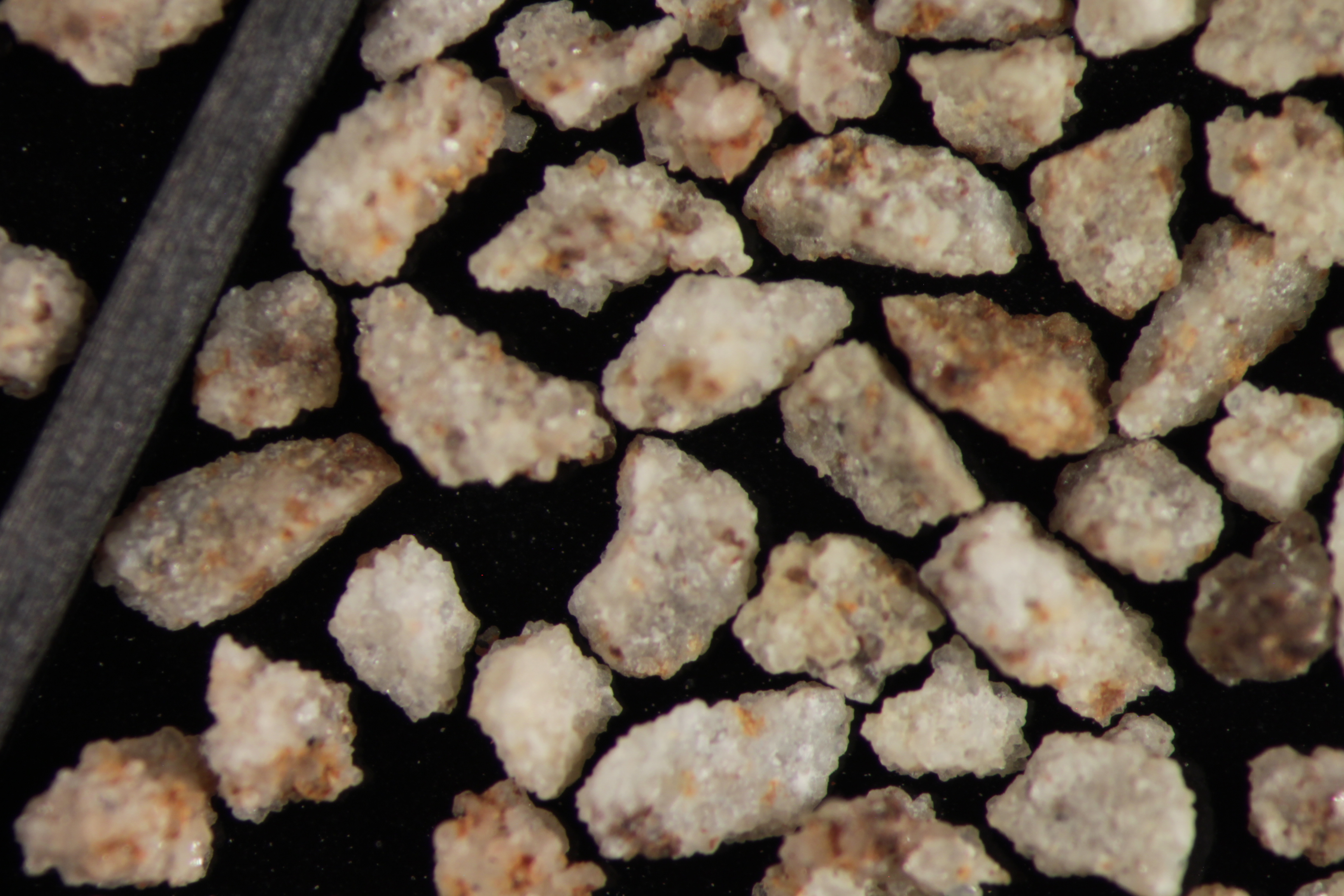
Sieving Results Reported Sample Weight (g): 114.7
|
|||||||||||||||||||||||||||||||||||||||||||||||||||||||||||||||||||||||||
| Sphericity | 0.64 |
|---|---|
| Roundness | 0.63 |
| First Primary | 70 |
| Second Primary | 140 |
|
Available Documents  View document [ENN_15_REDO_CRUSH5K2015_7_23_14_50_38.pdf] View document [ENN_15_SV_14_CRUSH6K2015_7_23_14_50_48.pdf] View document [ENN_15_SV_14_PRECRUSH2015_7_28_11_57_43.pdf] View document [ENN_15_SV_14_SPHERROUND1402015_7_28_11_57_50.pdf] View document [ENN_15_REDO_CRUSH5K2015_7_23_14_50_38.pdf] View document [ENN_15_SV_14_CRUSH6K2015_7_23_14_50_48.pdf] View document [ENN_15_SV_14_PRECRUSH2015_7_28_11_57_43.pdf] View document [ENN_15_SV_14_SPHERROUND1402015_7_28_11_57_50.pdf] |
|