Proppant Research Group
The data displayed below were collected during a joint project between the following departments at Montana Tech of The University of Montana: Geophysical Engineering and the Montana Bureau of Mines and Geology. The samples represent sandstones collected and analyzed for their potential use as proppant material.
| Sample Name | DILL-05-SV-14 | Site Name | DILL-SV-14 |
|---|---|---|---|
| Latitude | 45.022842 | Longitude | -112.642474 |
| Geomethod | NAV-GPS | Datum | WGS84 |
| Elevation | 6866 | Township | 09S |
| County | MADISON | Range | 09W |
| 100K Quad | DILLON | Section | 25 |
| 24K Quad | GALLAGHER MOUNTAIN | Quarter Section | AD |
| Sample Taken | YES | ||
| Sample Date | 8/22/2014 | Formation Name | Quadrant Formation (*q) |
| Sampler Name | SUSAN VUKE | Sampler Notes | BLACKTAIL RANGE: EAST SIDE SHEEP CREEK CANYON; CONOVER RANCH, PRIVATE LOGGING ROAD ACCESS |
| Thickness | ~700 FT, BUT SAMPLED BLOCK NOT IN OC | Extent | LOOSE BLOCKS FRIABLE SS |
| References | |||
| Meets API Minimum Standards | Minerology | ||||||||||||||||||||||||||||||||||||||||||||||||||||||||||||||||||||||||
|---|---|---|---|---|---|---|---|---|---|---|---|---|---|---|---|---|---|---|---|---|---|---|---|---|---|---|---|---|---|---|---|---|---|---|---|---|---|---|---|---|---|---|---|---|---|---|---|---|---|---|---|---|---|---|---|---|---|---|---|---|---|---|---|---|---|---|---|---|---|---|---|---|---|
| NO | QUARTZ | ||||||||||||||||||||||||||||||||||||||||||||||||||||||||||||||||||||||||
| Pre Wash Weight (g) | Post Wash Weight (g) | ||||||||||||||||||||||||||||||||||||||||||||||||||||||||||||||||||||||||
| 639.1 | |||||||||||||||||||||||||||||||||||||||||||||||||||||||||||||||||||||||||
| Material Notes | |||||||||||||||||||||||||||||||||||||||||||||||||||||||||||||||||||||||||
| USED CONE CRUSHER | |||||||||||||||||||||||||||||||||||||||||||||||||||||||||||||||||||||||||
|
Sieving Results Reported Sample Weight (g): 101.4
|
|||||||||||||||||||||||||||||||||||||||||||||||||||||||||||||||||||||||||
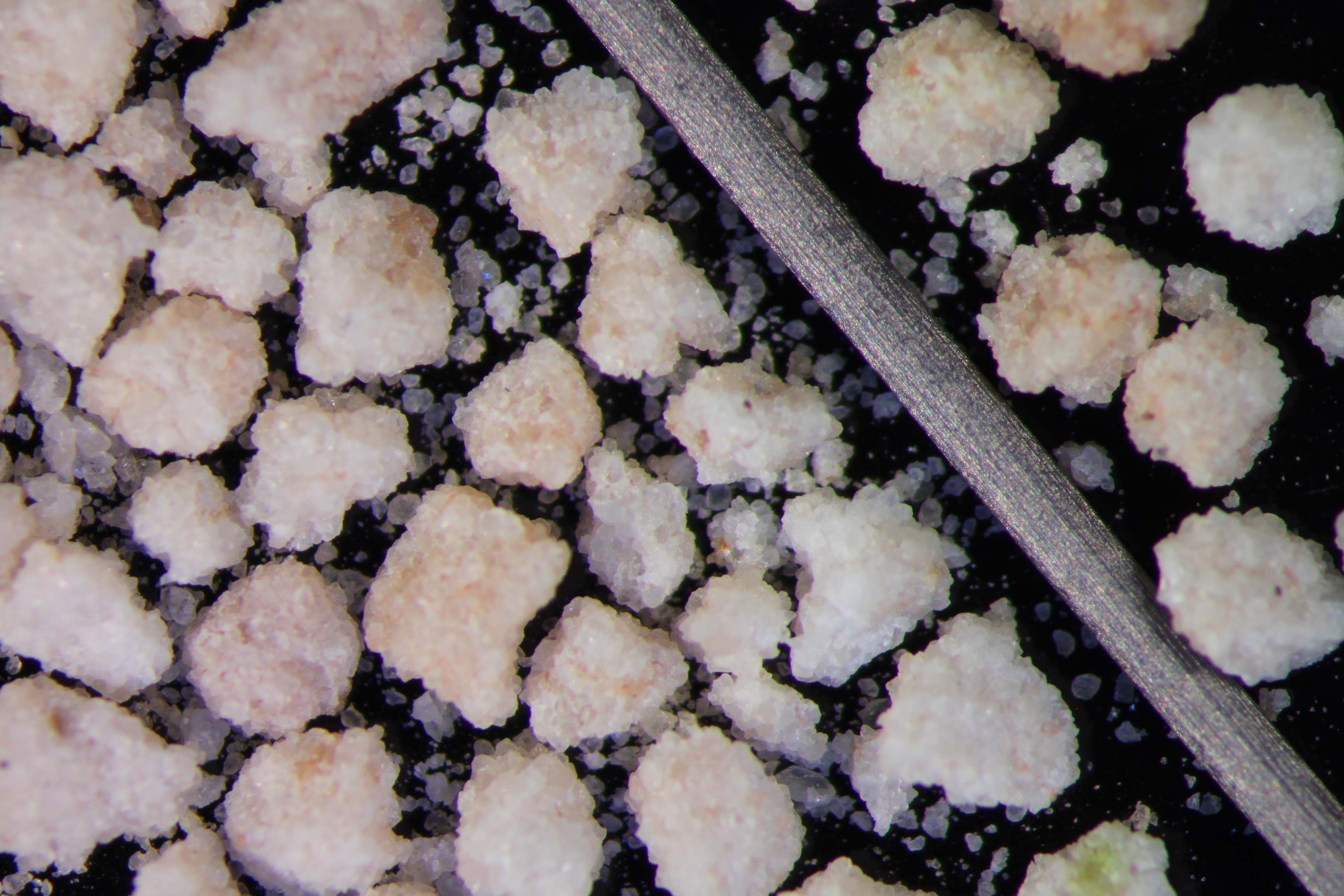
| Sphericity | 0.66 |
|---|---|
| Roundness | 0.65 |
| First Primary | 70 |
| Second Primary | 140 |
|
Available Documents  View document [DILL_05_SV_14_SPHERE_ROUND0232015_8_13_11_10_50.pdf] View document [DILL_05_SV_14_PRECRUSH0222016_2_5_12_49_52.pdf] View document [DILL_05_SV_14_CRUSH5K0442016_2_5_12_50_1.pdf] View document [DILL_05_SV_14_CRUSH6K2016_2_5_12_50_8.pdf] View document [DILL_05_SV_14_SPHERE_ROUND0232015_8_13_11_10_50.pdf] View document [DILL_05_SV_14_PRECRUSH0222016_2_5_12_49_52.pdf] View document [DILL_05_SV_14_CRUSH5K0442016_2_5_12_50_1.pdf] View document [DILL_05_SV_14_CRUSH6K2016_2_5_12_50_8.pdf] |
|