Proppant Research Group
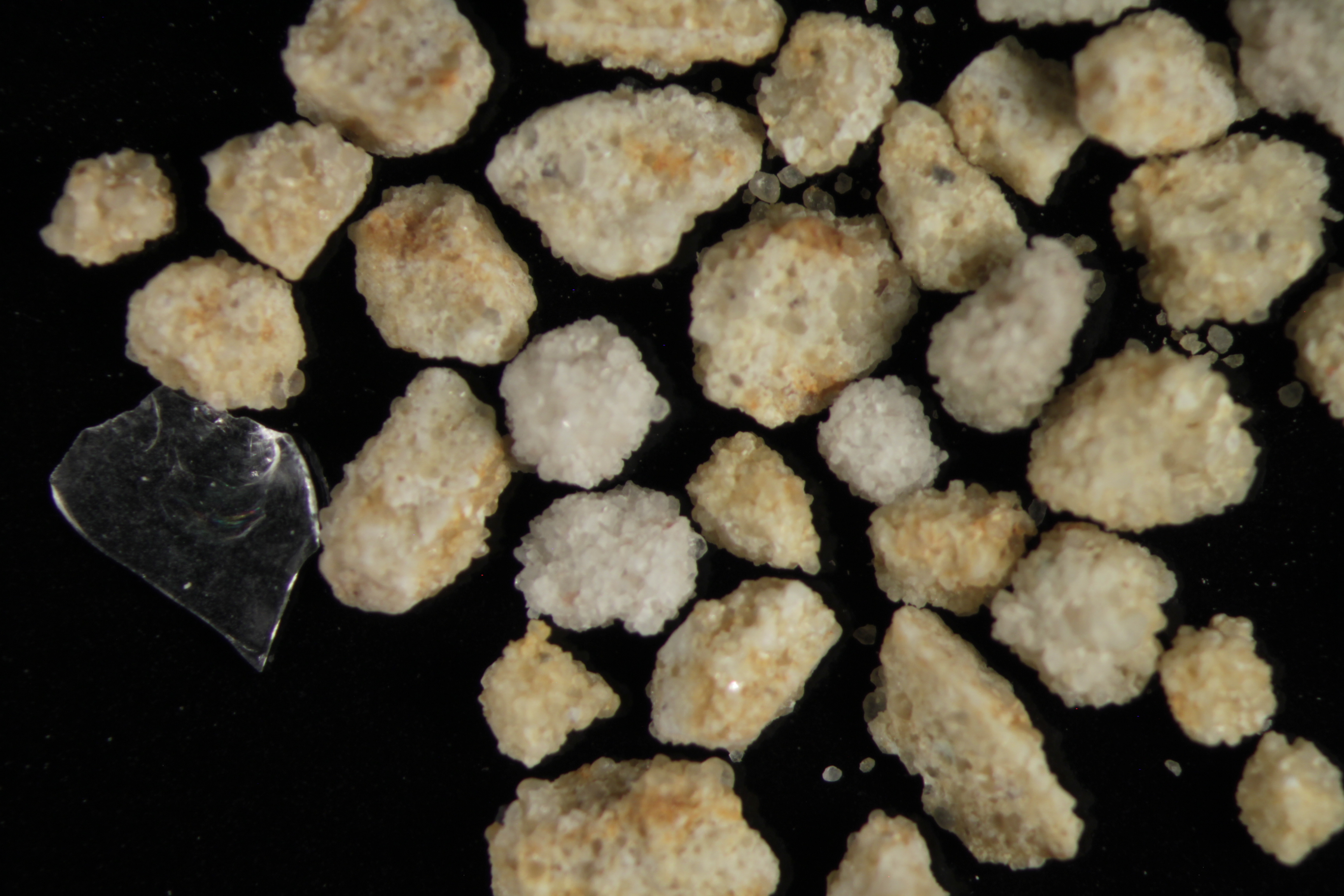
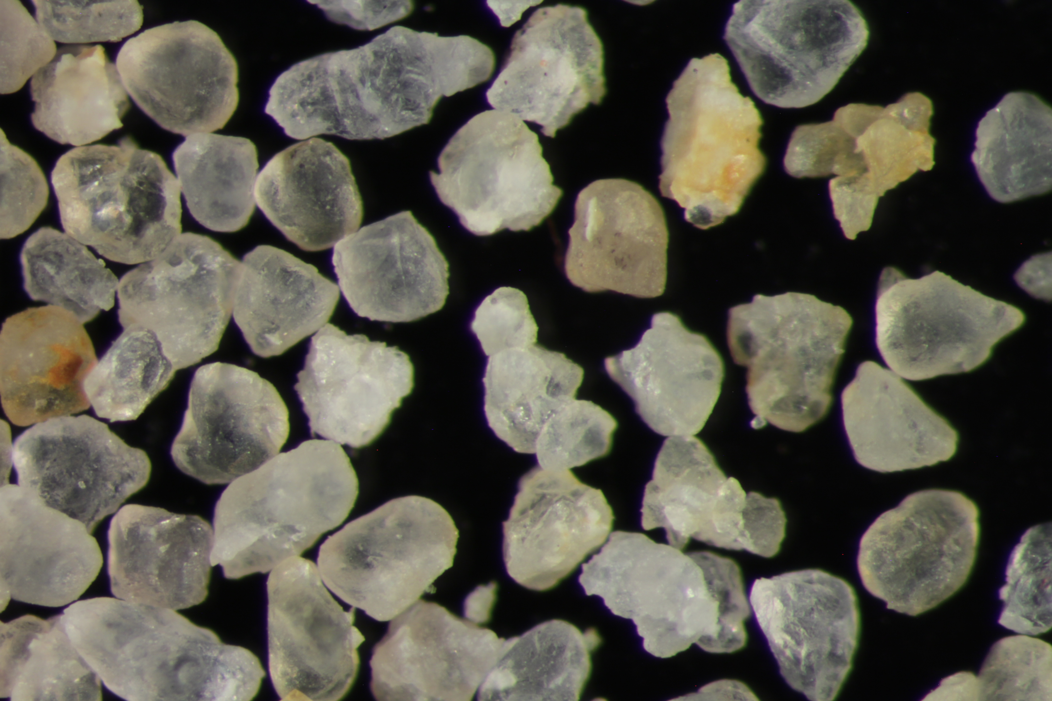
The data displayed below were collected during a joint project between the following departments at Montana Tech of The University of Montana: Geophysical Engineering and the Montana Bureau of Mines and Geology. The samples represent sandstones collected and analyzed for their potential use as proppant material.
| Sample Name | LIMA-08-SV-14 | Site Name | LIMA-SV-14 |
|---|---|---|---|
| Latitude | 44.579585 | Longitude | -112.692466 |
| Geomethod | NAV-GPS | Datum | WGS84 |
| Elevation | 6753 | Township | 14S |
| County | BEAVERHEAD | Range | 09W |
| 100K Quad | LIMA | Section | 34 |
| 24K Quad | GALLAGHER GULCH | Quarter Section | BB |
| Sample Taken | YES | ||
| Sample Date | 8/13/2014 | Formation Name | Quadrant Formation (*q) |
| Sampler Name | SUSAN VUKE | Sampler Notes | TENDOY RANGE: ALONG WEST FORK LITTLE SHEEP CREEK ROAD |
| Thickness | ~500 FT | Extent | SS BLOCKS ON HILLSIDE FROM OC ABOVE |
| References | |||
| Meets API Minimum Standards | Minerology | ||||||||||||||||||||||||||||||||||||||||||||||||||||||||||||||||||||||||
|---|---|---|---|---|---|---|---|---|---|---|---|---|---|---|---|---|---|---|---|---|---|---|---|---|---|---|---|---|---|---|---|---|---|---|---|---|---|---|---|---|---|---|---|---|---|---|---|---|---|---|---|---|---|---|---|---|---|---|---|---|---|---|---|---|---|---|---|---|---|---|---|---|---|
| YES | QUARTZ | ||||||||||||||||||||||||||||||||||||||||||||||||||||||||||||||||||||||||
| Pre Wash Weight (g) | Post Wash Weight (g) | ||||||||||||||||||||||||||||||||||||||||||||||||||||||||||||||||||||||||
| 1339.7 | 907.2 | ||||||||||||||||||||||||||||||||||||||||||||||||||||||||||||||||||||||||
| Material Notes | |||||||||||||||||||||||||||||||||||||||||||||||||||||||||||||||||||||||||
| SAMPLE CONTAINED GLASS PARTICLES | |||||||||||||||||||||||||||||||||||||||||||||||||||||||||||||||||||||||||
|
Sieving Results Reported Sample Weight (g): 117.2
|
|||||||||||||||||||||||||||||||||||||||||||||||||||||||||||||||||||||||||
| Sphericity | 0.66 |
|---|---|
| Roundness | 0.66 |
| First Primary | 70 |
| Second Primary | 140 |
|
Available Documents  View document [LIMA_08_SV_14_PRECRUSH2015_8_4_13_52_34.pdf] View document [LIMA_08_SV_14_SPHERANDROUND2015_8_4_14_0_27.pdf] View document [LIMA_08_SV_14_CRUSH_5K2015_8_4_14_0_41.pdf] View document [LIMA_08_SV_14_CRUSH_6K2015_8_4_14_0_51.pdf] View document [LIMA_08_SV_14_PRECRUSH2015_8_4_13_52_34.pdf] View document [LIMA_08_SV_14_SPHERANDROUND2015_8_4_14_0_27.pdf] View document [LIMA_08_SV_14_CRUSH_5K2015_8_4_14_0_41.pdf] View document [LIMA_08_SV_14_CRUSH_6K2015_8_4_14_0_51.pdf] |
|