Proppant Research Group
The data displayed below were collected during a joint project between the following departments at Montana Tech of The University of Montana: Geophysical Engineering and the Montana Bureau of Mines and Geology. The samples represent sandstones collected and analyzed for their potential use as proppant material.
| Sample Name | ENN-07-SV-14 | Site Name | ENN-SV-14 |
|---|---|---|---|
| Latitude | 45.090977 | Longitude | -111.862455 |
| Geomethod | NAV-GPS | Datum | WGS84 |
| Elevation | 8465 | Township | 08S |
| County | MADISON | Range | 02W |
| 100K Quad | ENNIS | Section | 32 |
| 24K Quad | BROOMTAIL RIDGE | Quarter Section | DD |
| Sample Taken | YES | ||
| Sample Date | 8/21/2014 | Formation Name | Quadrant Formation (*q) |
| Sampler Name | SUSAN VUKE | Sampler Notes | GRAVELLY RANGE: ALONG DEVILS LANE DEVILS LANE PART OF RD 290 |
| Thickness | ~ 250 FT, BUT ONLY LOOSE BLOCKS EXPOSED AT SURFAC | Extent | LOOSE BLOCKS IN MEADOW |
| References | |||
| Meets API Minimum Standards | Minerology | ||||||||||||||||||||||||||||||||||||||||||||||||||||||||||||||||||||||||
|---|---|---|---|---|---|---|---|---|---|---|---|---|---|---|---|---|---|---|---|---|---|---|---|---|---|---|---|---|---|---|---|---|---|---|---|---|---|---|---|---|---|---|---|---|---|---|---|---|---|---|---|---|---|---|---|---|---|---|---|---|---|---|---|---|---|---|---|---|---|---|---|---|---|
| YES | QUARTZ | ||||||||||||||||||||||||||||||||||||||||||||||||||||||||||||||||||||||||
| Pre Wash Weight (g) | Post Wash Weight (g) | ||||||||||||||||||||||||||||||||||||||||||||||||||||||||||||||||||||||||
| 1340.9 | 182.6 | ||||||||||||||||||||||||||||||||||||||||||||||||||||||||||||||||||||||||
| Material Notes | |||||||||||||||||||||||||||||||||||||||||||||||||||||||||||||||||||||||||
| USED CONE CRUSHER, NOT ENOUGH MATERIAL TO CRUSH AT 7000 PSI | |||||||||||||||||||||||||||||||||||||||||||||||||||||||||||||||||||||||||
|
Sieving Results Reported Sample Weight (g): 110
|
|||||||||||||||||||||||||||||||||||||||||||||||||||||||||||||||||||||||||
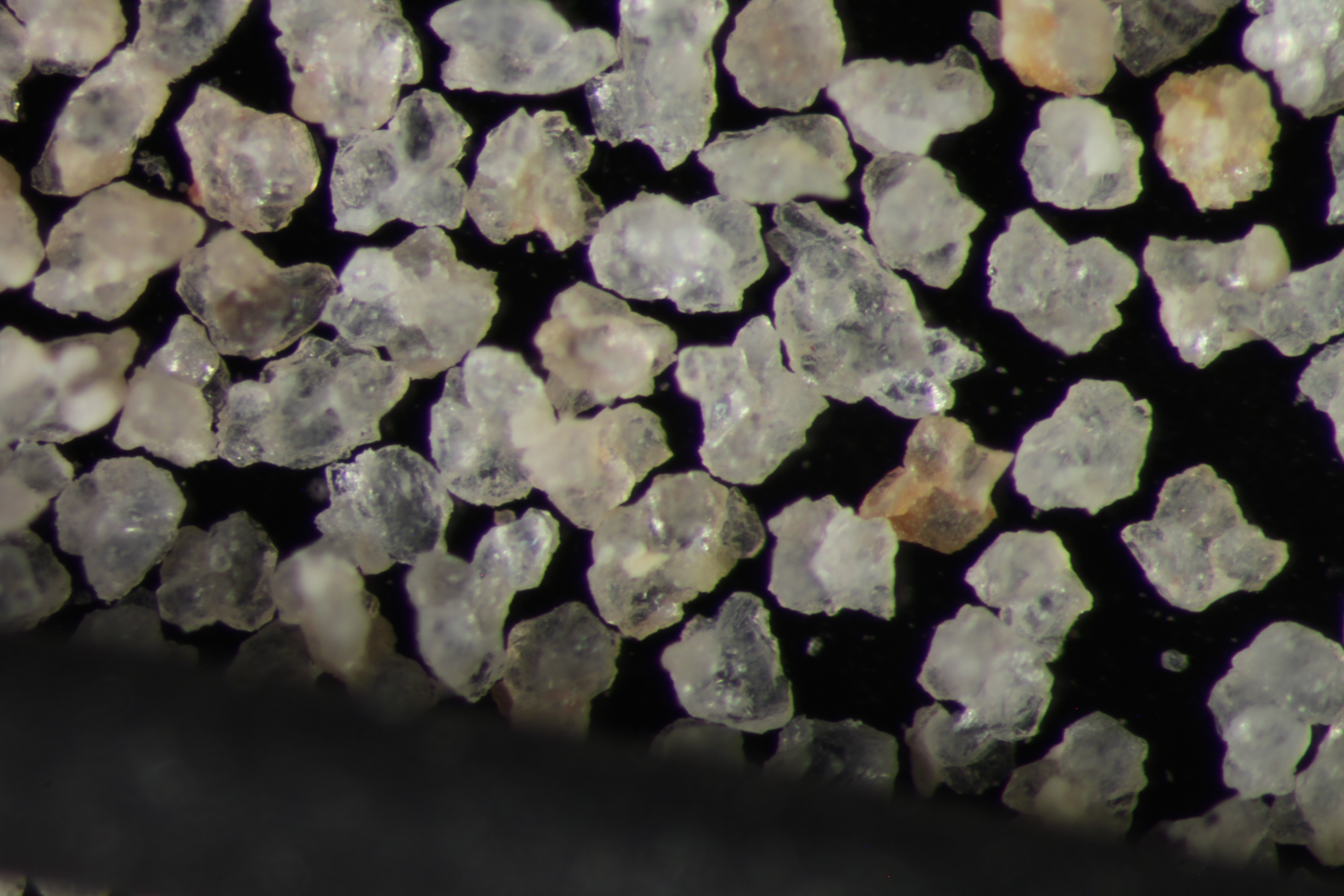
| Sphericity | 0.65 |
|---|---|
| Roundness | 0.64 |
| First Primary | 70 |
| Second Primary | 140 |
|
Available Documents  View document [ENN_07_SV_14_CRUSH6K2015_7_23_14_7_7.pdf] View document [ENN_07_SV_14_SPHER_ROUND2015_7_23_14_7_12.pdf] View document [ENN_07_SV_14_PRECRUSH0492015_12_29_13_6_51.pdf] View document [ENN_07_SV_14_CRUSH6K2015_7_23_14_7_7.pdf] View document [ENN_07_SV_14_SPHER_ROUND2015_7_23_14_7_12.pdf] View document [ENN_07_SV_14_PRECRUSH0492015_12_29_13_6_51.pdf] |
|