Proppant Research Group
The data displayed below were collected during a joint project between the following departments at Montana Tech of The University of Montana: Geophysical Engineering and the Montana Bureau of Mines and Geology. The samples represent sandstones collected and analyzed for their potential use as proppant material.
| Sample Name | C-12 | Site Name | C-12 |
|---|---|---|---|
| Latitude | 45.88603 | Longitude | -112.67204 |
| Geomethod | NAV-GPS | Datum | NAD83 |
| Elevation | 5825 | Township | 02N |
| County | SILVER BOW | Range | 09W |
| 100K Quad | BUTTE SOUTH | Section | 26 |
| 24K Quad | BUXTON | Quarter Section | |
| Sample Taken | YES | ||
| Sample Date | 6/19/2014 | Formation Name | Quadrant Formation (*q) |
| Sampler Name | ALEC,TIM, ALICIA | Sampler Notes | SLIGHT REACTION TO ACID |
| Thickness | Extent | ||
| References | |||
| Meets API Minimum Standards | Minerology | ||||||||||||||||||||||||||||||||||||||||||||||||||||||||||||||||||||||||
|---|---|---|---|---|---|---|---|---|---|---|---|---|---|---|---|---|---|---|---|---|---|---|---|---|---|---|---|---|---|---|---|---|---|---|---|---|---|---|---|---|---|---|---|---|---|---|---|---|---|---|---|---|---|---|---|---|---|---|---|---|---|---|---|---|---|---|---|---|---|---|---|---|---|
| NO | OTHER MINERALS | ||||||||||||||||||||||||||||||||||||||||||||||||||||||||||||||||||||||||
| Pre Wash Weight (g) | Post Wash Weight (g) | ||||||||||||||||||||||||||||||||||||||||||||||||||||||||||||||||||||||||
| 1711.8 | 1637.6 | ||||||||||||||||||||||||||||||||||||||||||||||||||||||||||||||||||||||||
| Material Notes | |||||||||||||||||||||||||||||||||||||||||||||||||||||||||||||||||||||||||
| USED CONE CRUSHER | |||||||||||||||||||||||||||||||||||||||||||||||||||||||||||||||||||||||||
|
Sieving Results Reported Sample Weight (g): 120
|
|||||||||||||||||||||||||||||||||||||||||||||||||||||||||||||||||||||||||
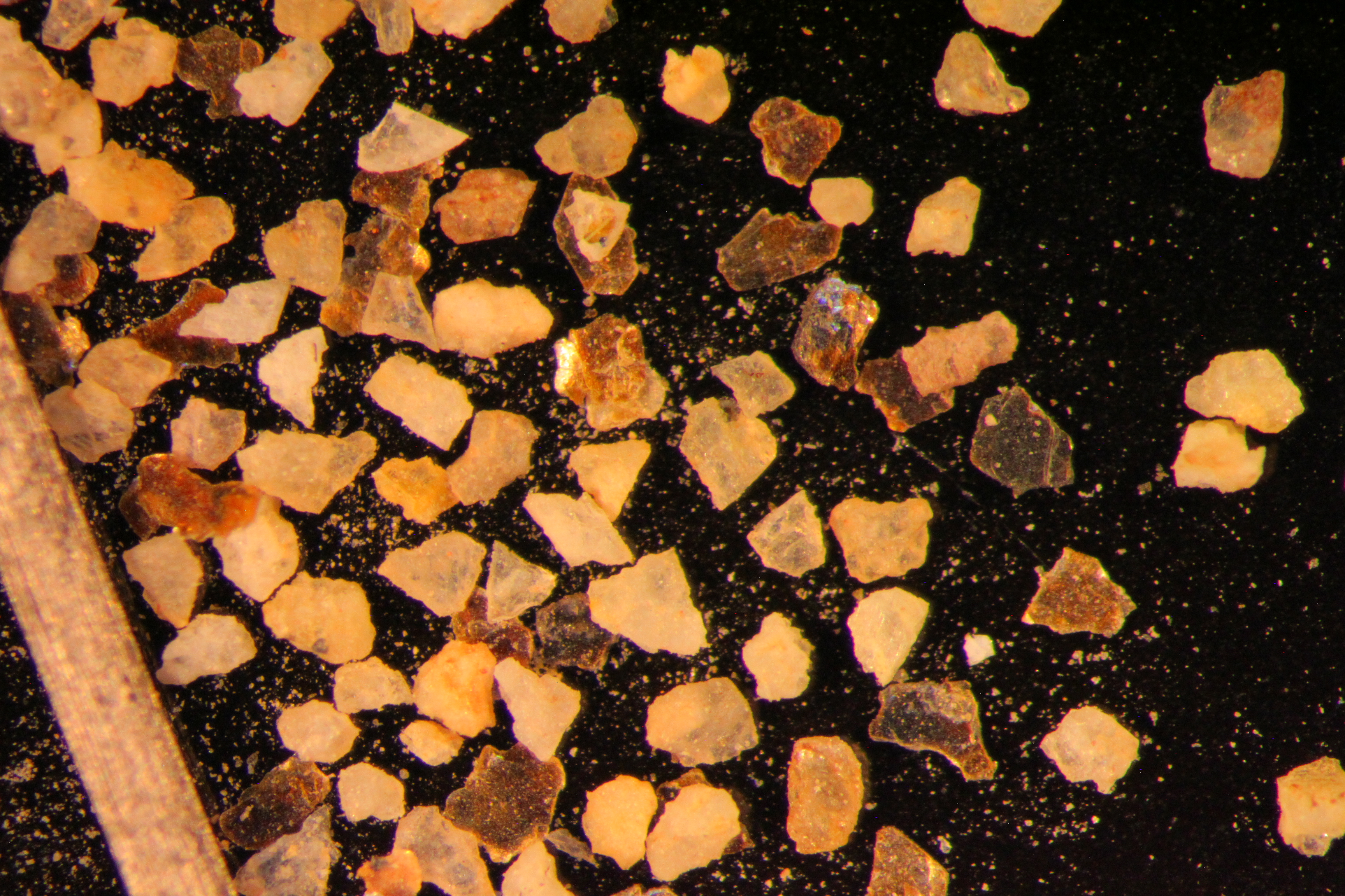
| Sphericity | |
|---|---|
| Roundness | |
| First Primary | 16 |
| Second Primary | 30 |
|
Available Documents  View document [C_12_PRECRUSH1872015_8_17_10_26_46.pdf] View document [C_12_PRECRUSH1872015_8_17_10_26_46.pdf] |
|