Proppant Research Group
The data displayed below were collected during a joint project between the following departments at Montana Tech of The University of Montana: Geophysical Engineering and the Montana Bureau of Mines and Geology. The samples represent sandstones collected and analyzed for their potential use as proppant material.
| Sample Name | CFD-08-SV-14 | Site Name | CFD-SV-14 |
|---|---|---|---|
| Latitude | 46.90974 | Longitude | -111.894582 |
| Geomethod | NAV-GPS | Datum | NAD83 |
| Elevation | 4567 | Township | 13N |
| County | LEWIS AND CLARK | Range | 02W |
| 100K Quad | CANYON FERRY DAM | Section | 5 |
| 24K Quad | BEARTOOTH MOUNTAIN | Quarter Section | BC |
| Sample Taken | YES | ||
| Sample Date | 5/30/2014 | Formation Name | Kootenai Formation, Sunburst Member (Kks) |
| Sampler Name | SUSAN VUKE | Sampler Notes | ALONG WILLOW CREEK RD; WELL EXPOSED DIP SLOPE |
| Thickness | ~200 | Extent | ~200 |
| References | |||
|
Site Photographs 


|
|||
| Meets API Minimum Standards | Minerology | ||||||||||||||||||||||||||||||||||||||||||||||||||||||||||||||||||||||||
|---|---|---|---|---|---|---|---|---|---|---|---|---|---|---|---|---|---|---|---|---|---|---|---|---|---|---|---|---|---|---|---|---|---|---|---|---|---|---|---|---|---|---|---|---|---|---|---|---|---|---|---|---|---|---|---|---|---|---|---|---|---|---|---|---|---|---|---|---|---|---|---|---|---|
| NO | QUARTZ | ||||||||||||||||||||||||||||||||||||||||||||||||||||||||||||||||||||||||
| Pre Wash Weight (g) | Post Wash Weight (g) | ||||||||||||||||||||||||||||||||||||||||||||||||||||||||||||||||||||||||
| 450.7 | 313.5 | ||||||||||||||||||||||||||||||||||||||||||||||||||||||||||||||||||||||||
| Material Notes | |||||||||||||||||||||||||||||||||||||||||||||||||||||||||||||||||||||||||
|
Sieving Results Reported Sample Weight (g): 118.1
|
|||||||||||||||||||||||||||||||||||||||||||||||||||||||||||||||||||||||||
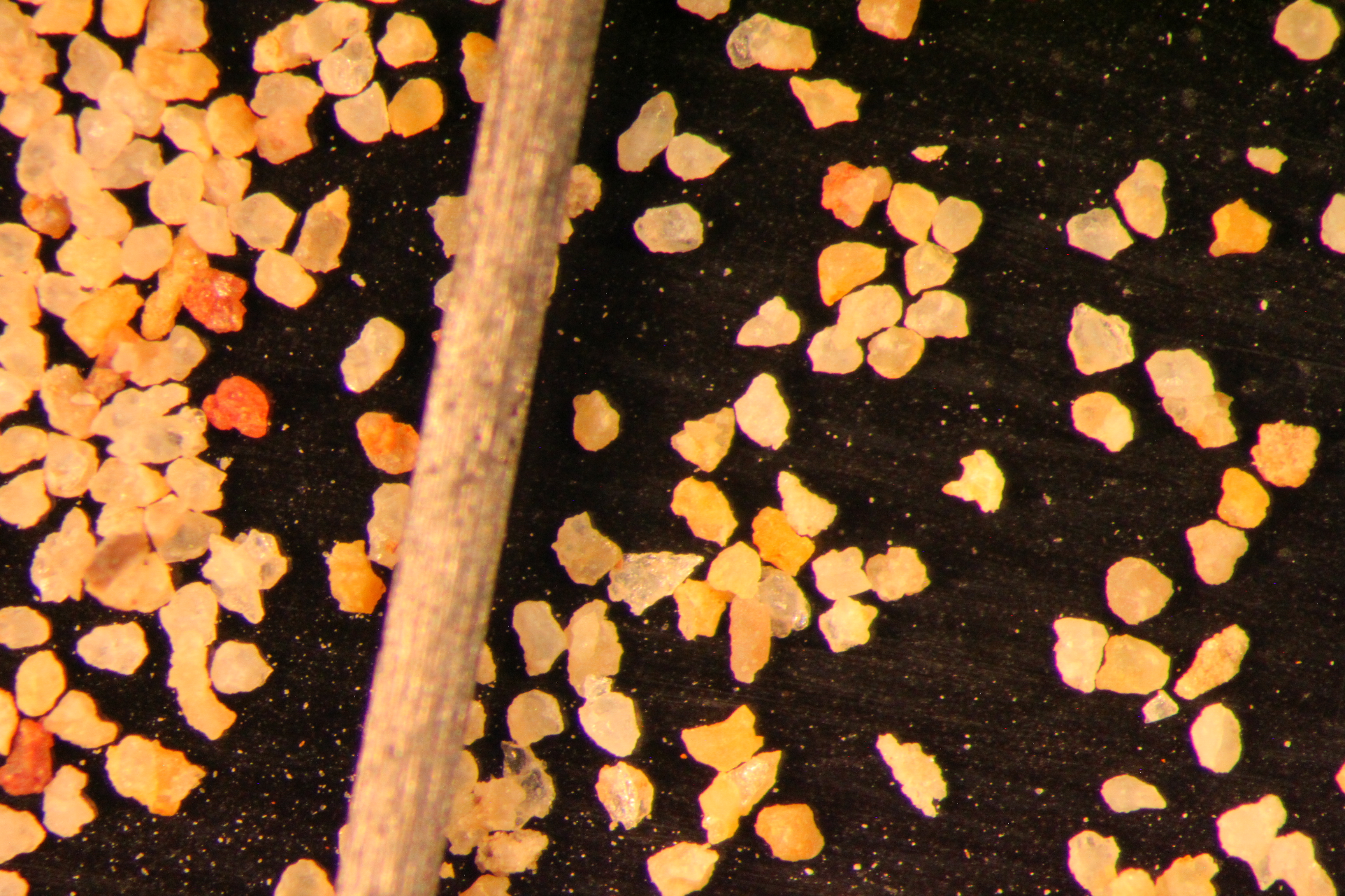
| Sphericity | 0.59 |
|---|---|
| Roundness | 0.54 |
| First Primary | 70 |
| Second Primary | 140 |
|
Available Documents  View document [CFD_08_SV_14_PRECRUSH2015_8_13_11_51_40.pdf] View document [CFD_08_SV_14_SPHERE_ROUND_140MESH0742015_12_29_15_49_10.pdf] View document [CFD_08_SV_14_PRECRUSH2015_8_13_11_51_40.pdf] View document [CFD_08_SV_14_SPHERE_ROUND_140MESH0742015_12_29_15_49_10.pdf] |
|