

Proppant Research Group
The data displayed below were collected during a joint project between the following departments at Montana Tech of The University of Montana: Geophysical Engineering and the Montana Bureau of Mines and Geology. The samples represent sandstones collected and analyzed for their potential use as proppant material.
| Sample Name | A38-2 | Site Name | A38-JG |
|---|---|---|---|
| Latitude | 48.42565 | Longitude | -104.21662 |
| Geomethod | NAV-GPS | Datum | WGS84 |
| Elevation | 2139 | Township | 31N |
| County | SHERIDAN | Range | 58E |
| 100K Quad | CULBERTSON | Section | 20 |
| 24K Quad | SUNNYHILL SCHOOL | Quarter Section | BC |
| Sample Taken | YES | ||
| Sample Date | 8/30/2013 | Formation Name | Eolian sand (Qe) |
| Sampler Name | JAY GUNDERSON | Sampler Notes | COUNTY LINE RD EAST, 2.5 MI N ON DAGMAR RD TO SANDHILLS BMA SIGN | GLACIAL AEOLIAN DUNE SS, SHOVEL SAMPLE, CAN'T GET TO DUNES |
| Thickness | Extent | ||
| References | |||
|
Site Photographs 

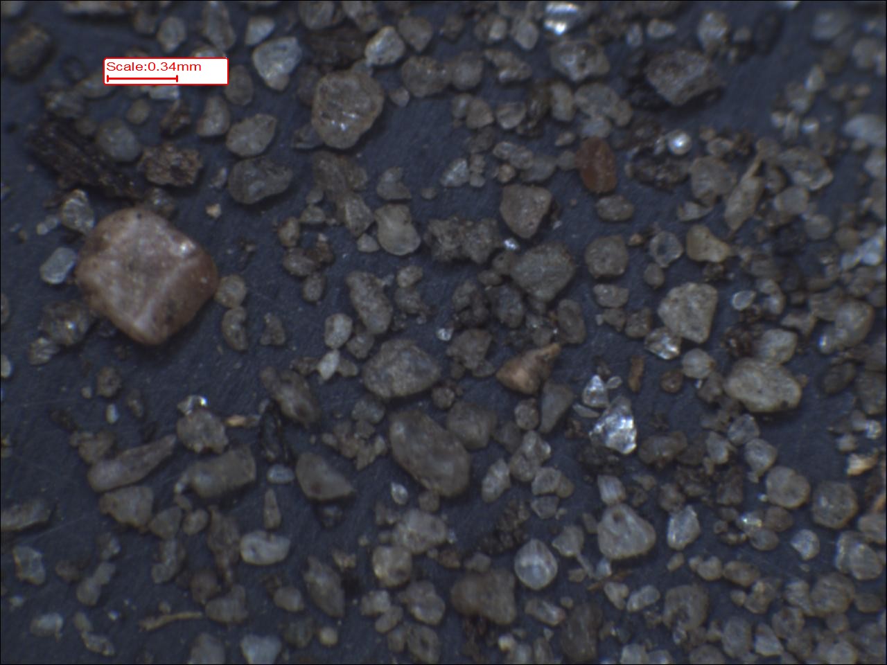
|
|||
| Meets API Minimum Standards | Minerology | ||||||||||||||||||||||||||||||||||||||||||||||||||||||||||||||||||||||||
|---|---|---|---|---|---|---|---|---|---|---|---|---|---|---|---|---|---|---|---|---|---|---|---|---|---|---|---|---|---|---|---|---|---|---|---|---|---|---|---|---|---|---|---|---|---|---|---|---|---|---|---|---|---|---|---|---|---|---|---|---|---|---|---|---|---|---|---|---|---|---|---|---|---|
| YES | QUARTZ | ||||||||||||||||||||||||||||||||||||||||||||||||||||||||||||||||||||||||
| Pre Wash Weight (g) | Post Wash Weight (g) | ||||||||||||||||||||||||||||||||||||||||||||||||||||||||||||||||||||||||
| Material Notes | |||||||||||||||||||||||||||||||||||||||||||||||||||||||||||||||||||||||||
|
Sieving Results Reported Sample Weight (g): 167.52
|
|||||||||||||||||||||||||||||||||||||||||||||||||||||||||||||||||||||||||
| Sphericity | 0.62 |
|---|---|
| Roundness | 0.66 |
| First Primary | 70 |
| Second Primary | 140 |
|
Available Documents  View document [A38_02_PRECRUSH1922015_12_4_9_15_7.pdf] View document [A38_02_SPHERE_ROUND1932015_12_4_9_15_30.pdf] View document [A38_02_5K0882015_12_4_9_15_52.pdf] View document [A38_02_6K0862015_12_4_9_16_5.pdf] View document [A38_02_PRECRUSH1922015_12_4_9_15_7.pdf] View document [A38_02_SPHERE_ROUND1932015_12_4_9_15_30.pdf] View document [A38_02_5K0882015_12_4_9_15_52.pdf] View document [A38_02_6K0862015_12_4_9_16_5.pdf] |
|


