Proppant Research Group
The data displayed below were collected during a joint project between the following departments at Montana Tech of The University of Montana: Geophysical Engineering and the Montana Bureau of Mines and Geology. The samples represent sandstones collected and analyzed for their potential use as proppant material.
| Sample Name | A37-2 | Site Name | A37-JG |
|---|---|---|---|
| Latitude | 48.33148 | Longitude | -104.5196 |
| Geomethod | NAV-GPS | Datum | WGS84 |
| Elevation | 2054 | Township | 30N |
| County | ROOSEVELT | Range | 55E |
| 100K Quad | CULBERTSON | Section | 23 |
| 24K Quad | JOHNSON LAKE | Quarter Section | DD |
| Sample Taken | YES | ||
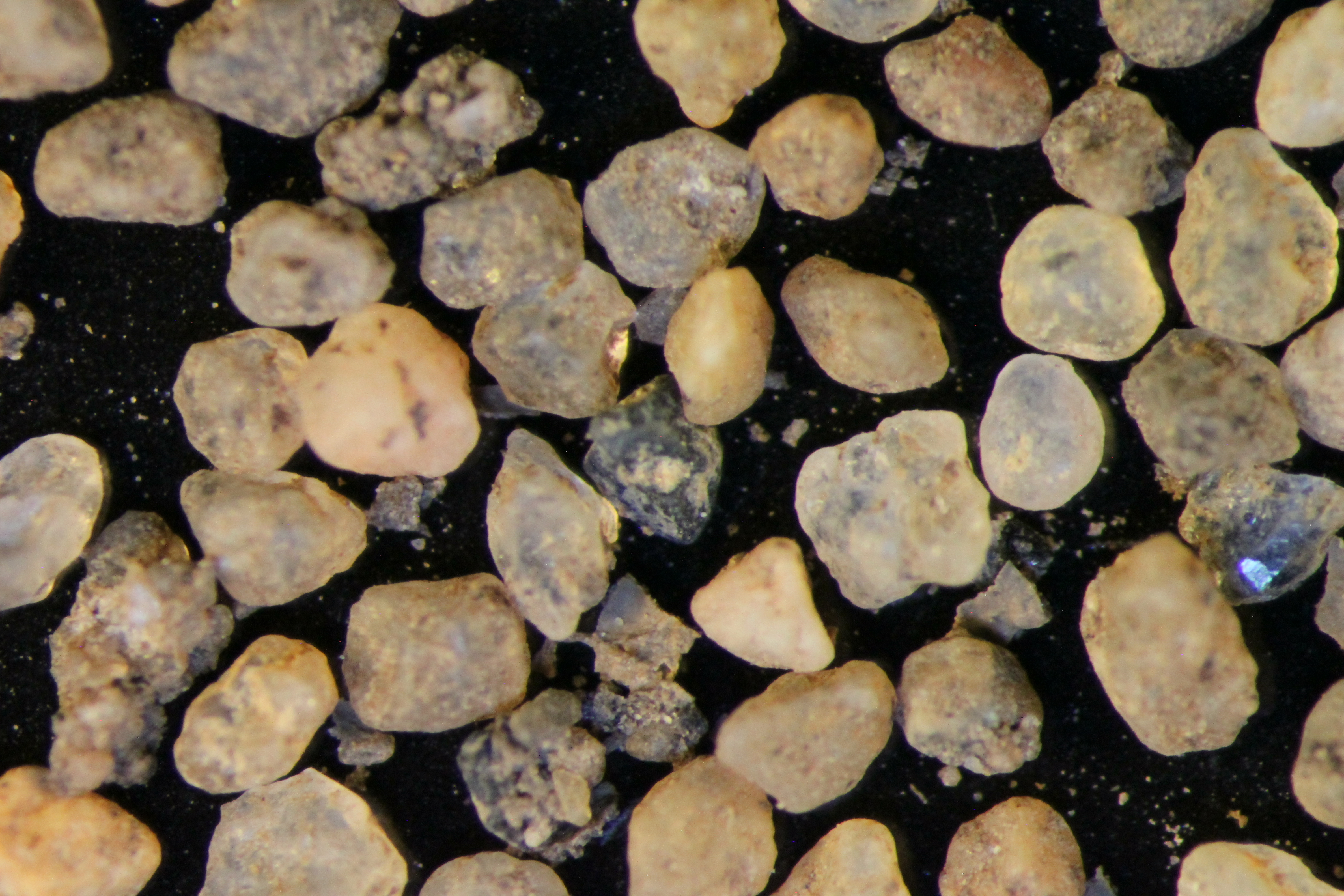
| Sample Date | 8/30/2013 | Formation Name | Eolian sand (Qe) |
| Sampler Name | JAY GUNDERSON | Sampler Notes | 1 MI WEST OF FROID ON HWY 344, 1/2 MI SO | GLACIAL AEOLIAN DUNE SS, CORE FROM 1-3', UPPER 0.5' DIRTY, LOWER 1.5' CLEAN, YLW, COARSE |
| Thickness | Extent | ||
| References | |||
|
Site Photographs 
|
|||
| Meets API Minimum Standards | Minerology | ||||||||||||||||||||||||||||||||||||||||||||||||||||||||||||||||||||||||
|---|---|---|---|---|---|---|---|---|---|---|---|---|---|---|---|---|---|---|---|---|---|---|---|---|---|---|---|---|---|---|---|---|---|---|---|---|---|---|---|---|---|---|---|---|---|---|---|---|---|---|---|---|---|---|---|---|---|---|---|---|---|---|---|---|---|---|---|---|---|---|---|---|---|
| NO | OTHER MINERALS | ||||||||||||||||||||||||||||||||||||||||||||||||||||||||||||||||||||||||
| Pre Wash Weight (g) | Post Wash Weight (g) | ||||||||||||||||||||||||||||||||||||||||||||||||||||||||||||||||||||||||
| Material Notes | |||||||||||||||||||||||||||||||||||||||||||||||||||||||||||||||||||||||||
|
Sieving Results Reported Sample Weight (g): 211.25
|
|||||||||||||||||||||||||||||||||||||||||||||||||||||||||||||||||||||||||
| Sphericity | |
|---|---|
| Roundness | |
| First Primary | 40 |
| Second Primary | 70 |
|
Available Documents  View document [A37_02_PRECRUSH2792015_12_4_9_13_14.pdf] View document [A37_02_PRECRUSH2792015_12_4_9_13_14.pdf] |
|